EUROPE · UKRAINE GUIDE
Ukraine Map & Regions: Geography, Place Names and Access
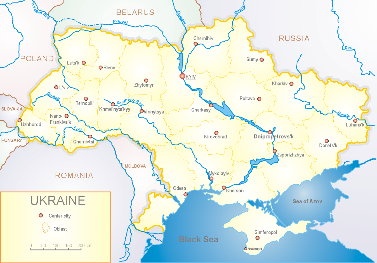
A map of Ukraine is a starting point for understanding the country, not permission to travel across it. This guide explains the relationships between regions, cities, rivers and borders, and shows how to read a static map alongside information that changes. It is designed for cultural research, future planning and the geographical questions behind a necessary journey. It does not identify a safe route, an open border crossing or the current line of fighting.
Read the map before using it
The accompanying map shows Ukraine as a geographical whole, including Crimea. Its source and production information appear below the image, with a full-size version for reading labels. Administrative boundaries, international borders, landscape regions and areas under occupation describe different things. A regional boundary on a reference map does not show where a civilian can travel today. This page deliberately does not add an undated military-control overlay.
The legacy source map retains Dnipropetrovsk for today’s Dnipro and Kirovohrad for today’s Kropyvnytskyi. These city names changed in 2016; see the Ukrainian Institute of National Memory’s Dnipro record and the Verkhovna Rada’s Kropyvnytskyi record. The map’s production-data date is not supplied by its file description, so it is a reference image with explicitly retained older labels, not a current administrative update.
First inspect the legend, language and scale. Check whether a label names a city, an oblast or a larger historical region. Some older maps use earlier spellings or names; these should be matched to current Ukrainian names before using a booking confirmation or an official notice. Preserve the original map's date when saving it. A recently downloaded file can still depict older information, and the date you accessed it does not update the geography it represents.
UN General Assembly coverage on Ukraine's territorial integrity provides context for why Crimea is represented within Ukraine. The map is not an endorsement of entry through Russia or a claim of Ukrainian administrative control over every depicted place. For current restrictions, consult official regional travel advice and the Health & Safety guide.
The country's main geographical relationships
Ukraine lies in eastern Europe, with the Black Sea to the south and the Sea of Azov to the southeast. Its land neighbours are Poland, Slovakia, Hungary, Romania, Moldova, Belarus and Russia. Listing a neighbouring country is a geographical fact; it does not establish that its border with Ukraine is open to regular travellers. In particular, do not read a national road line as an available international connection.
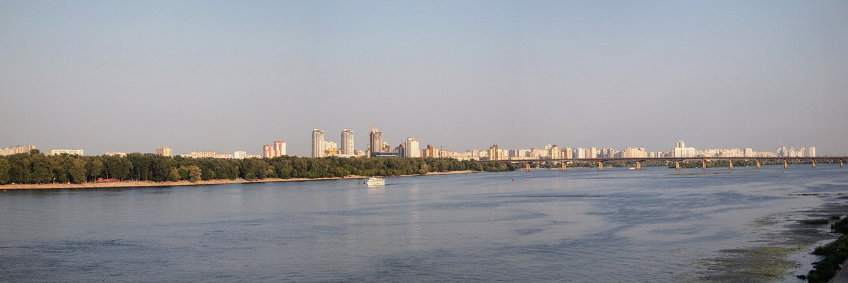
The Dnipro is a useful organising feature. Kyiv sits on the river in the north-central part of the country, while Dnipro and Zaporizhzhia lie farther downstream. River banks, reservoirs and bridges can affect how a city is laid out. The presence of a bridge on a small-scale map does not confirm its current condition or access arrangements. Avoid using architectural photographs of bridges to infer a working crossing.
To the west are the Carpathians and the borderland connections of Zakarpattia. The north contains woodland and wetland landscapes associated with Polissia; central Ukraine includes extensive agricultural country, while southern landscapes meet the Black Sea coast. These broad descriptions help explain climate and cultural variation. They should not be converted into a simple west-to-east ranking of personal safety.
Compare regions by the question you are researching
The following comparison is an editorial orientation tool. The groupings are broad geographical descriptions, not new administrative units or a hierarchy of places to visit. Use the official name of the actual city and oblast when consulting local instructions.
On a narrow screen, swipe the table or focus it and use the left and right arrow keys to see every column.
| Geographical focus | Useful reference places | What the comparison explains | What it does not verify |
|---|---|---|---|
| North-central Dnipro area | Kyiv | Capital-city geography and river setting | Bridge access or a local journey time |
| Western urban centres | Lviv, Chernivtsi | Distinct architectural and cultural histories | A universally safe western travel zone |
| Carpathian and trans-Carpathian areas | Uzhhorod and mountain regions | Relief, watershed and border relationships | Open trails or unrestricted borderland access |
| Black Sea south | Odesa, Mykolaiv, Kherson | Maritime geography and river-to-sea relationships | Open beaches, ports or swimming areas |
| East and southeast | Kharkiv, Donetsk, Luhansk, Zaporizhzhia | Important cities and regional geography | Current control, access or civilian transport |
| Crimea | Simferopol, Sevastopol | Ukrainian peninsula between the Black Sea and Sea of Azov | A permissible tourism route into occupied territory |
The table helps answer “where is this place?” without implying “how should I go there?” Keep those two questions separate in your notes. For example, learning that Odesa is a Black Sea city helps explain its history; it does not establish a beach itinerary. Understanding Lviv's western location helps with orientation, but the destination and transit route still need their own assessment.
Cities, oblasts and historical regions
An oblast is an administrative region. A city with the same name is not the whole oblast, and local instructions may refer to a wider area than your accommodation address. Kyiv city and Kyiv Oblast should not be treated as interchangeable labels. Similarly, a news report about a region should not automatically be interpreted as a statement about every street in its administrative centre.
Historical names such as Galicia, Bukovyna and Podillia describe cultural and geographical contexts whose boundaries do not necessarily match a contemporary administrative map. They can be useful when researching architecture, family history or food traditions. Specify which meaning you are using rather than drawing a neat modern boundary around a historical subject. The History & Culture page develops that cultural background.
Use Kyiv and Odesa consistently in contemporary English editorial text. If an archive, older map or business uses Kiev or Odessa, explain the relationship when it matters rather than inventing a second city. Retain a property's actual official spelling in a booking reference. Copy the full Ukrainian address and any entrance instructions into offline notes; a translated city name alone is not a usable arrival address.
Distances, transfers and border geography
A country-scale map is poor evidence for door-to-door travel time. Straight-line distance excludes the route actually available, stops, changes, border procedures and the effect of an interrupted connection. Even a route planner's estimate can depend on assumptions that have not been checked. This page therefore does not publish fixed driving times between cities or promise that a border-to-city transfer can be completed in one day.
For a necessary journey, make a separate transport record: exact departure point, destination address, date, operator, ticket conditions and what happens if a connection fails. Then use the Getting Around guide to identify the official transport and border sources that need checking. A geographical relationship can remain useful even when the operational plan has to change.
Cross-border research also involves the country through which you would transit. A railway station in Poland, Slovakia, Hungary, Romania or Moldova belongs to that country's transport system and entry rules. Do not treat every border-side city as an interchangeable gateway. Record the actual connection and the permissions relevant to each traveller instead of choosing a line simply because it looks shortest on the map.
Landscape research and protected areas
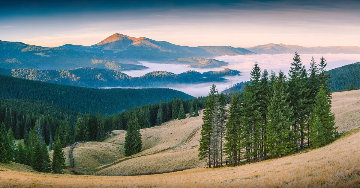
Mountain shading can explain why the weather and terrain differ between a regional centre and a higher valley. It does not identify a marked walking trail. Likewise, a green area on a small-scale map does not show current permission to enter a reserve. Check the protected area's own information, local restrictions and any border-zone conditions before interpreting a landscape as a recreational opportunity.
The Carpathian Biosphere Reserve is a useful subject for learning about mountain habitats and conservation. Its landscape belongs in a country geography guide, but this page supplies no trailhead, off-road shortcut or remote overnight route. During the war, a visually appealing valley should not be presented as an escape from the need to assess access. Use the reserve’s own information for conservation research, and seek current permission separately before considering an activity.
Questions to resolve before relying on a map
Ask who made the map, when its underlying information was prepared and what its legend claims to show. Check whether current place names match your transport and accommodation documents. Establish whether a route line describes infrastructure or an actual dated service. If you cannot answer one of those questions, retain the map for orientation and find a more appropriate source for the operational decision.
For planning a future visit, use this page to understand regional differences and develop a reading list. For an unavoidable journey, the map supports a wider assessment involving official advice, legal entry, assistance and verified arrangements. Those tasks cannot be replaced by a detailed image, a popular map application or a photograph from someone else's visit. The main Ukraine guide connects the different planning questions.