
EUROPE · UKRAINE GUIDE
Ukraine Beaches: Coastal Geography, Restrictions and Historical Context


Ukraine's beaches belong to a country at war. This page explains the geography behind familiar coastal names and the questions that must be resolved before anyone interprets a beach description as permission to visit or swim. It does not provide a beach-hopping route, a list of currently open swimming areas or a recommendation to travel to occupied territory. Historical photographs are clearly contextual; people visible in an older image do not establish today's conditions.
The first decision is access, not water temperature
The UK's regional advice for Ukraine and the main travel-advice page should be read before making commitments. A weather forecast, hotel listing or restaurant opening notice cannot replace that advice. For anyone already in Ukraine, local authorities' current instructions also matter. This page cannot verify a particular stretch of shoreline for a particular day.
Beach access, permission to swim and practical emergency support are separate questions. An accessible promenade does not establish that the sand below it is open; an open commercial venue does not establish that entering the sea is permitted. An old review saying that someone swam without difficulty describes that person's experience at that time. It does not answer whether your proposed activity is authorised or appropriate.
If you cannot obtain current, location-specific information, do not fill the gap with an assumption that the absence of a visible barrier means access is allowed. Keep the place in your geographical or cultural research instead. The Health & Safety guide explains the wider decision about travel and assistance, which comes before choosing optional recreation.
Understand Ukraine's coast on a map
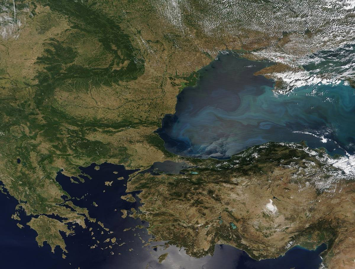


Ukraine's southern geography includes the Black Sea and the Sea of Azov. Odesa is a major Black Sea city, while other coastal areas belong to different administrative regions and face different circumstances. A single label such as “the Ukrainian Riviera” hides those distinctions. Use the Map & Regions page to identify the actual place and oblast before researching access.
A sea view, a sandy beach, a port and a river estuary are different environments. They should not be grouped into one generic swimming destination. A satellite image can help explain broad geographical relationships, but it cannot identify safe entry points, contamination, local restrictions or current military hazards. This guide deliberately avoids plotting a coastal driving itinerary or identifying remote alternatives to a closed beach.
When reading an older tourism article, check whether it describes pre-war facilities, travel times or transport connections. A dated reference to a resort may remain useful cultural history while being unsuitable operational advice. Preserve that distinction if you save the article. Downloading a page today does not make the page's original claims current.
Odesa and the names in older beach guides
Lanzheron, Otrada and Arcadia are names readers may encounter in older descriptions of Odesa's coastal recreation. Their familiarity does not establish the current status of any beach, venue or water access. A fixed walking or taxi time is not useful without the starting point, date and current access conditions. A route should not be inferred from a historical caption.
An older photograph of Lanzheron can show the relationship between an urban shoreline and the sea. It cannot confirm that a promenade, staircase or bathing area is available today. If the image contains umbrellas, visitors or beach furniture, those belong to the recorded scene. They should not be read as a forecast of what a traveller will find, or as a visual contradiction of official warnings.
Odesa also has a cultural and architectural history distinct from beach recreation. The UNESCO historic-centre record is a source for heritage research. Learning about the city's port history or architecture does not require presenting swimming as an essential activity. The History & Culture guide keeps that material separate from current access decisions.
Crimea and the Sea of Azov
Crimea, including Sevastopol, is Ukrainian territory under Russian occupation. Crimean resort names in older travel writing must not be interpreted as conventional current holiday recommendations. Sevastopol's history also cannot be reduced to a celebratory military-tourism description. The UN territorial-integrity record provides a clear starting point for the geographical and political distinction.
Yalta, Alupka and other coastal place names may appear in historical travel writing, art or family records. They can be discussed in those contexts without supplying an itinerary or presenting occupation as a normal visitor arrangement. We provide no routes into Crimea, no advice for bypassing restrictions and no suggestion that booking availability establishes legal entry. Consult your own government's current advice for the relevant warnings.
The Sea of Azov coast likewise cannot be described through a generic pre-war resort list. A coastline shown on a reference map is not an available recreational corridor. When researching a photograph or an archive, identify its precise location and date. Where access has not been established, keep the description historical rather than replacing missing evidence with a confident suggestion.
Lakes are not an automatic substitute
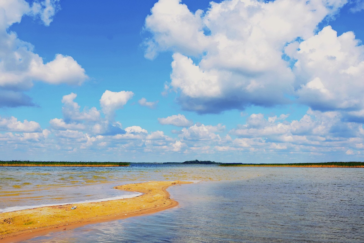

Lake Svityaz and the wider Shatsk lake area introduce another part of Ukraine's water geography. A lake landscape can be valuable for learning about northwestern habitats and the relationship between water and surrounding communities. It should not be presented as an automatically safe alternative to the Black Sea merely because it is farther from a coast or appears peaceful in a photograph.
For any water-related activity, current local instructions, permitted access, water conditions and the traveller's individual needs require separate assessment. A national park designation does not certify every place within its boundaries for swimming or unrestricted walking. Nor does a landscape photograph establish that visitor facilities, transport or emergency services are operating. This page does not verify a swimming point at Svityaz.
If the purpose is future research, compare the landscapes and cultural settings without making a booking or assigning a day-by-day route. Record which authority would need to supply current access information later. That approach preserves the value of learning about Ukraine's lakes while avoiding a misleading promise of an available holiday option.
Hazards cannot be judged from a photograph
The FCDO's safety information describes unexploded-weapons hazards and explains that flooding can redistribute dangerous objects. A clean-looking shoreline is not evidence that it has been assessed or cleared. Avoid approaching an unfamiliar object to photograph or identify it. Follow current local emergency instructions rather than using a travel article as a field-identification guide.
Even outside a war context, the colour of the water or the number of people present is a poor basis for assessing conditions. Here, additional restrictions and support limitations make casual inference especially inappropriate. This guide therefore gives no instructions for testing a closed area, entering an unmarked path or finding an unofficial beach. A quieter spot does not solve an unresolved access question.
A checklist for interpreting beach information
On a narrow screen, swipe the table or focus it and use the left and right arrow keys to see every column.
| Information you find | What it may tell you | What remains unresolved |
|---|---|---|
| Historic beach photograph | Appearance at a recorded time | Current access, hazards and facilities |
| Current weather forecast | Expected atmospheric conditions | Permission to enter or swim |
| Operating café or hotel | A commercial service may be advertised | Status of the adjoining beach or water |
| National park webpage | Conservation identity and institutional contact | Local access and activity conditions today |
| Social-media report | One person's account | Official permission and applicability to you |
Future coastal research
For a future journey, Ukraine's coasts and lakes can be researched through geography, history, conservation and dated photography. Choose sources that name their location and explain their scope. For present travel decisions, official advice and local instructions take priority over an appealing image or a remembered recommendation. Postponing recreation does not diminish the country's natural and cultural significance; it keeps the guide honest about what has and has not been established.